Individuals
Know if a storm is heading toward you, and at what time. Instant answer, no account needed.
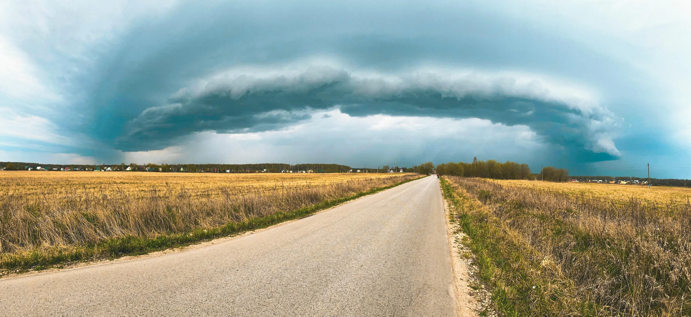
See if the storm affects meStorm tracking & trajectories
Is the storm heading your way,
and when?
Whether you're planning an event, chasing the perfect cell, or just want to know if you can head out tonight, one thing really matters: knowing where it's going.
Where do I start?Whether you're planning an event, chasing the perfect cell, or simply want to know if a storm is heading your way, Storm Predict answers the same question: where is the storm going, and when.
Know if a storm is heading toward you, and at what time. Instant answer, no account needed.
See if the storm affects meReal-time tracking, trajectories with uncertainty corridor, pre-convective detection, cell classification, lightning. The complete field tool.
Try 7 daysLocalized alerts on your sensitive sites and lead time to decide: secure, postpone, evacuate. Built for local authorities, events, construction and energy.
Discover Pro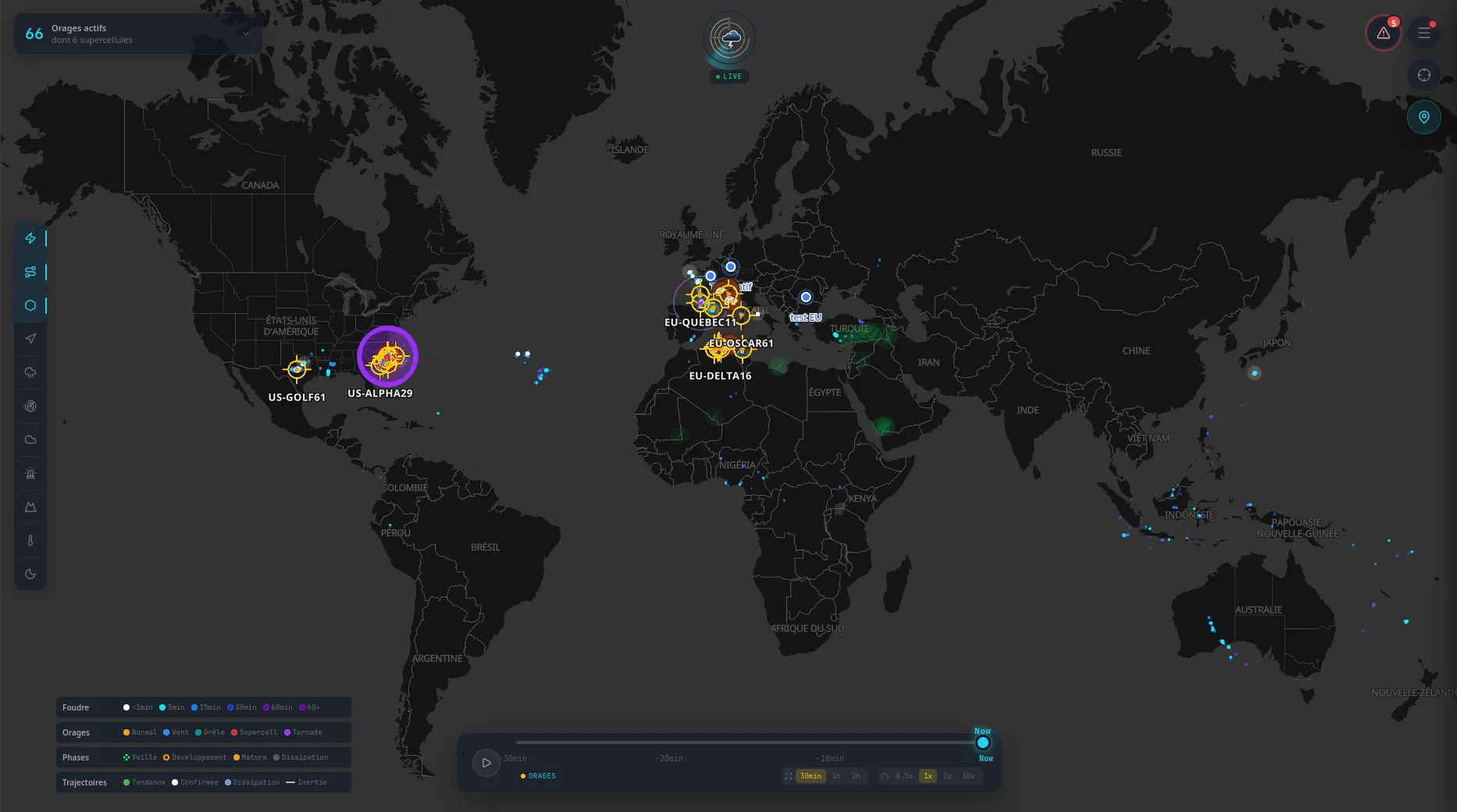
Live worldwide view · 66 active storms, 6 supercells tracked individually
You check the radar, the models, three apps. None tells you where the storm will be in an hour. So you drive on instinct.
Classic services show where the storm was 5 minutes ago. Not where it'll be. You're always behind.
At that resolution, your town and the next one are the same pixel. Impossible to pick a spot.
The alert drops when the storm is already here. No time to move, no time to find the right angle.
A white line on the map. The confirmed trajectory. The danger corridor. You have time to find the perfect open field, set up the tripod, and wait.
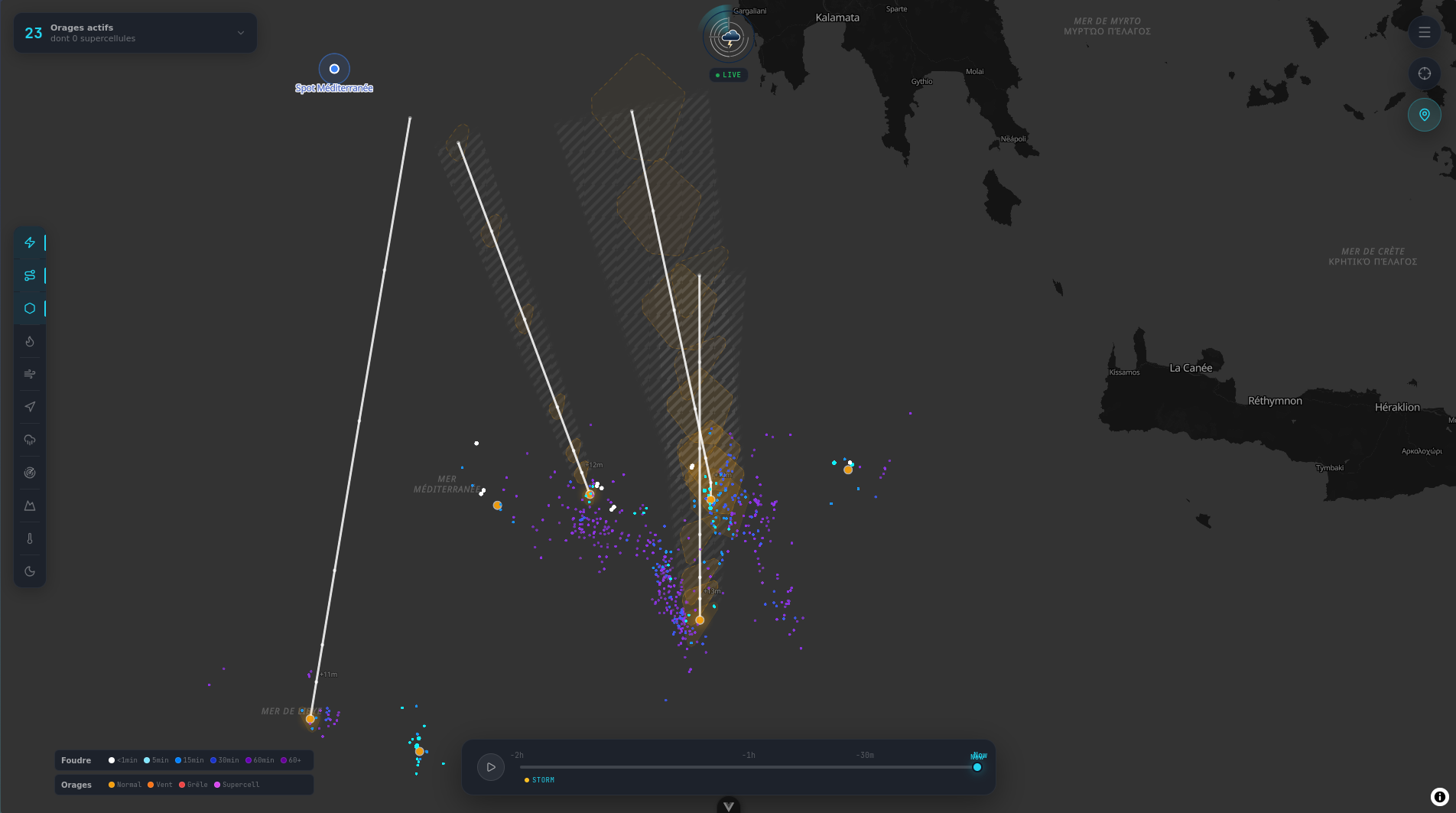
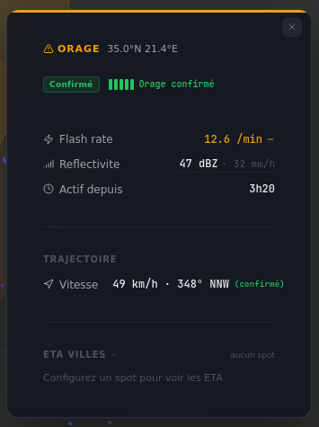
Flash rate, reflectivity, steering wind, shear, risk indices, alert history. Everything you need to decide in the field, on a single screen. High-resolution models wherever they're available (AROME in France and almost all of Spain, HRRR in the US, and more every season), composite radar and Doppler to back them up. When others see a region under the storm, you see which road to take.
Field validation
6.8 km median error at 30 min
Validated on 66,000 lightning strikes · Camargue session · March 22, 2026
2.8×
more accurate than baseline
66,000
strikes analyzed
3 h
prediction horizon
Built by a storm chaser, for storm chasers. Not a generic weather service. A field tool.
I was pleasantly surprised by the interface: aesthetic, clean, exactly the kind of tool you want to use in the field. I really like the Flash Rate, it instantly tells you the intensity of electrical activity. Impressive work.
Same features across all 3 plans. Only the duration changes.
These prices are for individuals. Are you a business? See Pro plans →
Sign up, then start your trial the day your first storm approaches. 7 days of full access, no credit card.
Perfect to test or cover a single chase
Choose MonthlyThe price drops as the season goes on
Choose SeasonalSave ~33% vs monthly
Choose AnnualNot ready yet? Stay informed about updates.
Storm Predict is a real-time storm tracking platform that automatically detects storm cells, calculates their trajectories up to 4 hours ahead, and sends personalized alerts. Built by a storm chaser, it leverages high-resolution models (AROME in France and almost all of Spain, HRRR in the US, and more every season), composite radar and Doppler.
Trajectories are calculated from atmospheric wind data from high-resolution models and analysis of the cell's past movement. The system produces a confirmed trajectory (white line) with a danger corridor and hourly predictions (+15min, +30min, +1h, +2h, +4h).
3 plans with the exact same features, only the duration changes: Monthly at €9.99 first month then €24.99/mo no commitment, Seasonal at €129 for 7 months (April-October, ~25% savings), and Annual at €199 for 12 months (~33% savings).
Storm Predict covers the entire world. Automatic tracking detects and follows storms on all continents in real time via the Blitzortung lightning detection network, backed by the most accurate local models and radars available in each region.